Authors: Joshua Dimasaka, Christian Geiß, Emily So
Published on: April 02, 2024
Impact Score: 8.4
Arxiv code: Arxiv:2404.01748
Summary
- What is new: Introduction of OpenSendaiBench and the use of ResNet-50 models for mapping disaster risk from remote sensing data.
- Why this is important: Many countries cannot monitor climate and disaster risk effectively due to the high costs of large-scale surveys.
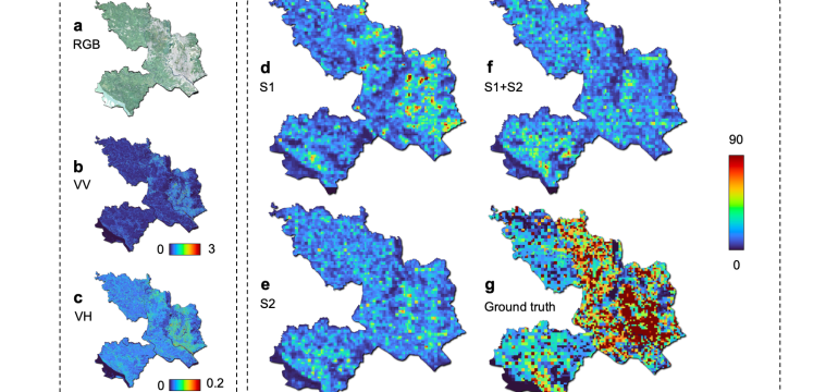
- What the research proposes: Using machine learning and time-series remote sensing data to map the distribution of exposure and physical vulnerability.
- Results: Successful mapping in Dhaka, Bangladesh demonstrates the potential for global disaster risk auditing over time.
Technical Details
Technological frameworks used: OpenSendaiBench
Models used: ResNet-50
Data used: Sentinel-1 SAR GRD and Sentinel-2 Harmonized MSI
Potential Impact
Disaster risk assessment firms, insurance companies, climate change mitigation businesses, NGOs, and governments in least developed countries.
Want to implement this idea in a business?
We have generated a startup concept here: RiskMapper.


Leave a Reply