Authors: Lei Li, Tianfang Zhang, Zhongyu Jiang, Cheng-Yen Yang, Jenq-Neng Hwang, Stefan Oehmcke, Dimitri Pierre Johannes Gominski, Fabian Gieseke, Christian Igel
Published on: March 04, 2024
Impact Score: 8.6
Arxiv code: Arxiv:2403.01932
Summary
- What is new: The fusion of 3D LiDAR measurements with 2D imagery for tree counting.
- Why this is important: Difficulty in counting individual trees in dense areas using traditional 2D remote sensing imagery.
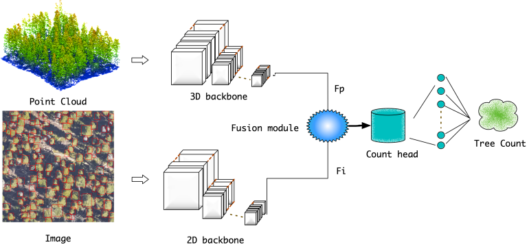
- What the research proposes: A deep learning approach that combines 3D LiDAR data with 2D imagery for improved tree counting accuracy.
- Results: FuseCountNet outperforms existing algorithms in tree counting accuracy.
Technical Details
Technological frameworks used: Deep Learning
Models used: FuseCountNet
Data used: 3D airborne LiDAR data and 2D imagery from the NeonTreeCount data set
Potential Impact
Sustainable forest management, Climate change mitigation sectors, Carbon credit market
Want to implement this idea in a business?
We have generated a startup concept here: EcoSight.


Leave a Reply