Authors: Miao Zhang, Salman Rahman, Vishwali Mhasawade, Rumi Chunara
Published on: February 08, 2024
Impact Score: 8.12
Arxiv code: Arxiv:2402.06059
Summary
- What is new: The research explores new ways of using street view imagery and AI to study how the environment impacts community health, specifically focusing on obesity and diabetes rates. It’s novel in showing how biases in AI and data can misinform decisions if not properly corrected.
- Why this is important: The use of street view imagery (like Google Street View) combined with AI for assessing community health can be biased, potentially leading to ineffective health interventions.
- What the research proposes: A comprehensive analysis of street view images combined with health, demographic, and socioeconomic data to develop a more robust, causal understanding of the environment’s impact on health outcomes.
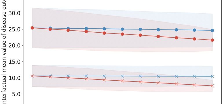
- Results: By adjusting for biases and using a causal framework, the research suggests targeted interventions in the built environment could significantly reduce obesity and diabetes rates more effectively than previously thought.
Technical Details
Technological frameworks used: Causal analysis framework
Models used: Artificial intelligence models for image analysis and statistical models for handling socioeconomic and health data
Data used: 2.02 million Google Street View (GSV) images, New York City health, demographic, and socioeconomic data
Potential Impact
Urban planning, public health interventions, AI development companies focused on community health, and data analytics firms
Want to implement this idea in a business?
We have generated a startup concept here: HealthScape Insights.


Leave a Reply